
Dubai Atlas 2026: Dubai Municipality Launches New Geographic and Visual Resource
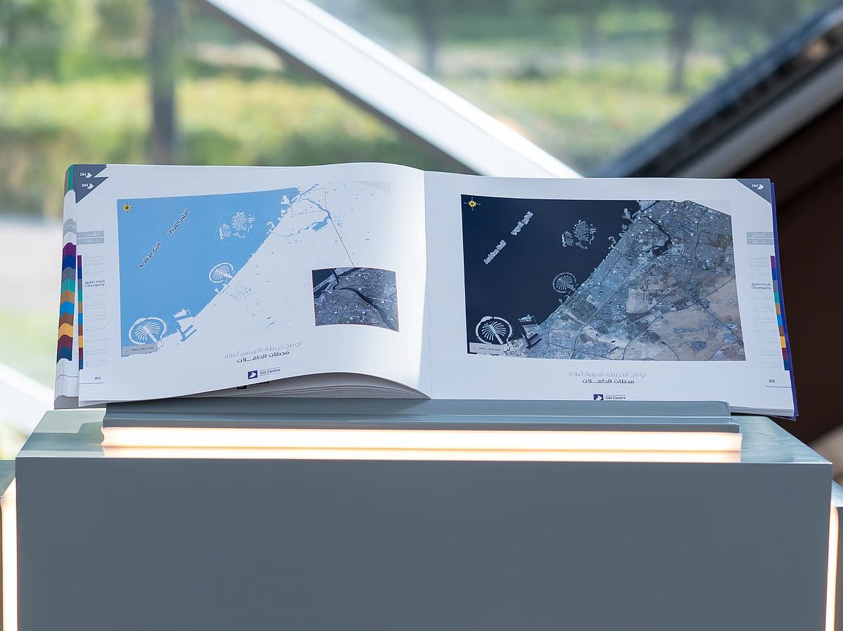
Dubai Municipality has launched Dubai Atlas, a comprehensive geographic and visual publication that documents the emirate’s transformation, urban development, natural features, infrastructure and community facilities.
The new resource brings together geospatial information, maps, aerial photographs and satellite imagery in one reference. It is designed to provide a deeper understanding of Dubai’s geographical identity, how the city has evolved and what its future development may look like.
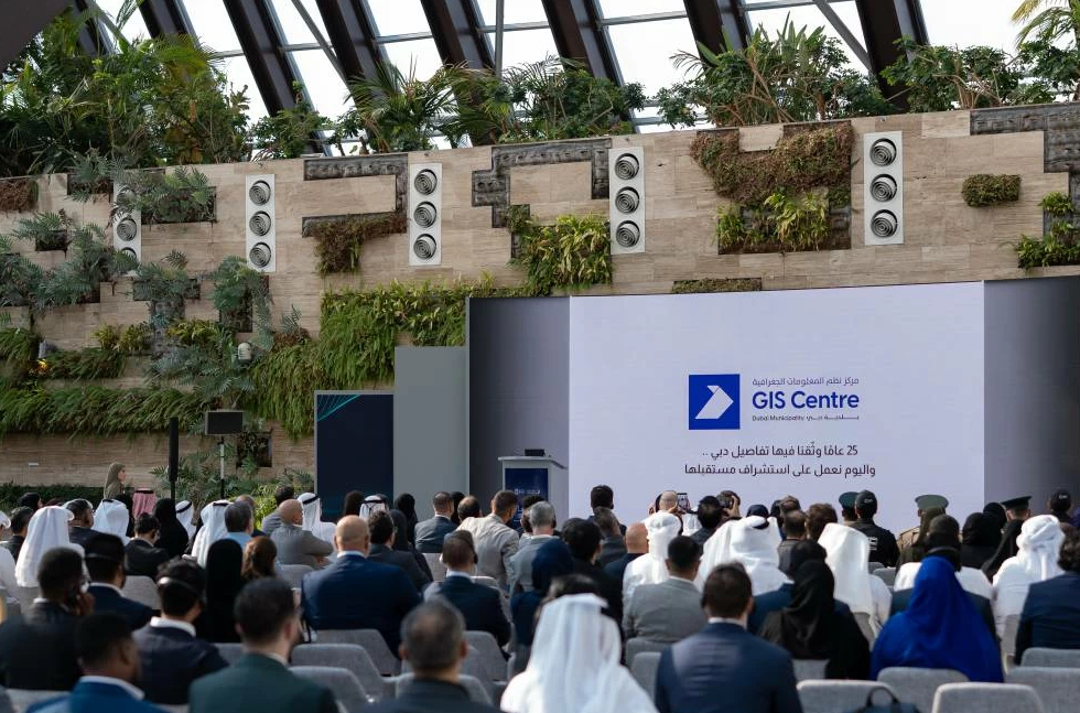
The launch took place on 19 November 2026, during an event organised by Dubai Municipality to mark the 25th anniversary of its Geographic Information Systems (GIS) Centre. The celebration was held under the theme “25 Years: From the First Map to the City of the Future” and coincided with World GIS Day.
What Is Dubai Atlas?
Dubai Atlas is a geographic and visual resource developed to present a comprehensive picture of Dubai.
It brings together different types of geographic information in one publication, allowing readers to explore the emirate’s physical characteristics, urban landscape, infrastructure and community facilities.
Rather than looking at individual maps or datasets separately, the atlas provides a combined reference that helps explain Dubai’s development and changing identity.
The publication covers several important aspects of the emirate, including:
- Dubai’s geographical and natural characteristics
- Urban growth and transformation
- Infrastructure and development
- Community facilities
- Geospatial information and mapping
- Aerial and satellite imagery
- Insights into Dubai’s future development
Dubai Municipality Launches Atlas During GIS Centre’s 25th Anniversary
The launch of Dubai Atlas was part of a special event organised by Dubai Municipality to celebrate 25 years of its Geographic Information Systems Centre.
The event’s theme was “25 Years: From the First Map to the City of the Future.” It reflects the development of geographic information systems in Dubai, from early mapping initiatives to the use of modern geospatial information.
The anniversary also coincided with World GIS Day, an international occasion that highlights the importance of geographic information systems and mapping technologies in understanding the world.
What Information Does Dubai Atlas Include?
One of the key features of Dubai Atlas is its combination of different geographic resources in a single reference.
| Information included | What it helps illustrate |
| Geospatial data | Geographic characteristics and location-based information |
| Maps | Dubai’s geographical and urban features |
| Aerial imagery | A view of the emirate from above |
| Satellite imagery | The wider landscape and changes over time |
| Infrastructure information | Important infrastructure and development |
| Community facilities | Facilities and services across the emirate |
| Natural characteristics | Dubai’s geographical and natural environment |
| Future development insights | Understanding the emirate’s development direction |
By bringing these resources together, Dubai Atlas offers a broader view of how the emirate has developed and how its different areas are connected.
Why Dubai Atlas Important?
Dubai has experienced significant urban and infrastructure development over the years. Understanding this transformation requires accurate geographic information and reliable mapping resources.
Dubai Atlas provides a consolidated visual reference that can help readers understand the emirate beyond individual buildings, roads and neighbourhoods.
Its potential value includes:
1. Understanding Dubai’s Urban Transformation
- The combination of maps and imagery helps illustrate the emirate’s geographical and urban evolution.
2. Bringing Geographic Information Together
- The atlas brings geospatial data, maps and aerial and satellite imagery into one reference, making different types of geographic information easier to explore together.
3. Highlighting Infrastructure and Community Facilities
- The publication documents infrastructure and community facilities, offering a broader picture of the built environment and the services that support communities.
4. Exploring Dubai’s Natural Characteristics
- In addition to urban development, the atlas documents the emirate’s geographical and natural features.
5. Providing Insights Into Future Development
- The resource also offers insights into Dubai’s future development, helping readers understand the direction of the emirate’s ongoing transformation.
What Is the Dubai Municipality GIS Centre?
The Geographic Information Systems (GIS) Centre is part of Dubai Municipality’s geographic information work.
GIS technology is used to collect, organise, analyse and present location-based information. It helps users understand how different features, facilities and infrastructure relate to specific geographical locations.
The centre’s 25th anniversary marks an important milestone in the development of geographic information systems in Dubai.
The theme, “25 Years: From the First Map to the City of the Future”, highlights the journey from early mapping activities to modern geographic information capabilities.
Dubai Atlas and the Future of Smart City Development
Geographic information plays an important role in understanding how cities grow and function. Maps, satellite images and geospatial datasets can help present complex urban information in a more accessible way.
Dubai Atlas brings these resources together to document the emirate’s development and distinctive identity.
As Dubai continues to evolve, geographic information and mapping resources remain important for understanding its infrastructure, communities, natural environment and future development.
Frequently Asked Questions
1. What is Dubai Atlas?
- Dubai Atlas is a comprehensive geographic and visual resource launched by Dubai Municipality. It documents Dubai’s transformation, geographical and natural characteristics, urban development, infrastructure and community facilities.
2. Who launched Dubai Atlas?
- Dubai Municipality launched Dubai Atlas during an event celebrating the 25th anniversary of its Geographic Information Systems Centre.
3. When was Dubai Atlas launched?
- Dubai Atlas was launched on 19 November 2026, coinciding with the GIS Centre’s 25th anniversary celebration and World GIS Day.
4. What information included in Dubai Atlas?
- The resource brings together geospatial data, maps, aerial imagery and satellite imagery. It also documents Dubai’s geographical features, urban development, infrastructure and community facilities.
5. Why Dubai Atlas launch linked to World GIS Day?
- The launch coincided with World GIS Day, an occasion that recognises the importance of geographic information systems and mapping technology.
6. What was the theme of the GIS Centre’s 25th anniversary?
- The anniversary event was held under the theme “25 Years: From the First Map to the City of the Future.”
7. Does Dubai Atlas provide information about future development?
- Yes. According to Dubai Municipality’s announcement, the publication offers insights into Dubai’s future development in addition to documenting its geographical and urban transformation.
Final Thoughts
The launch of Dubai Atlas marks an important milestone in Dubai Municipality’s geographic information initiatives. By bringing together maps, geospatial data and aerial and satellite imagery, the publication provides a comprehensive visual reference to the emirate’s past transformation, present characteristics and future development.
The launch during the GIS Centre’s 25th anniversary and World GIS Day also highlights the growing importance of geographic information in understanding Dubai’s development as a modern city.